WyACT Wyoming Anticipating Climate Transitions: what the project studies in the Mountain West 2026
Explore WyACT's study of Wyoming climate transitions. A practical explainer on how the project analyzes water, hydrology, ecosystems, and community decision making in the Mountain West.
WyACT reframes the Mountain West water challenge around a single truth: climate signals are now driving streamflow shifts at multiple scales, not just in one basin. WyACT maps those signals across Wyoming and adjacent basins, translating complex models into actionable layers for managers, planners, and policymakers. Most shifts in snowpack timing show up earlier than prior projections, not as a single weather event. The result is a concise, place-based picture of where and when water stress is likely to tighten first, and what governance steps follow.
In 2026, researchers in the Mountain West rely on integrated climate-hydrology outputs, governance scenarios, and community inputs to align planning with projected transitions in river systems. What WyACT does, and how it does it, becomes essential reading for watershed managers preparing for the next water-year cycle, and for policy makers seeking verifiable steps to adapt at the county and state levels. WyACT’s co-production approach is a core signal that governance can be adaptive without waiting for a perfect forecast.

What WyACT actually studies in Wyoming's climate-transition landscape
| Topic | Focus area | Key questions | Data sources | Stakeholders | Notes |
|---|---|---|---|---|---|
| Climate-transition landscape | Wyoming-specific | How transitions manifest | Observational data | Communities | Qualitative elements included |
| Biophysical systems | Water, ecosystems | What change signals? | Observations | Agencies | Short-term signals noted |
| Socioeconomic | Impacts & adaptation | Who is affected? | Surveys | Residents | Scenarios qualitative |
| Policy context | Regulations | What governs actions? | Policy documents | Governments | Dynamic over time |
| Gaps & needs | Research gaps | Where to study next? | Expert input | Researchers | Prioritized |
Compiled November 2026; check the provider's site for current details.
What WyACT actually studies in Wyoming's climate-transition landscape
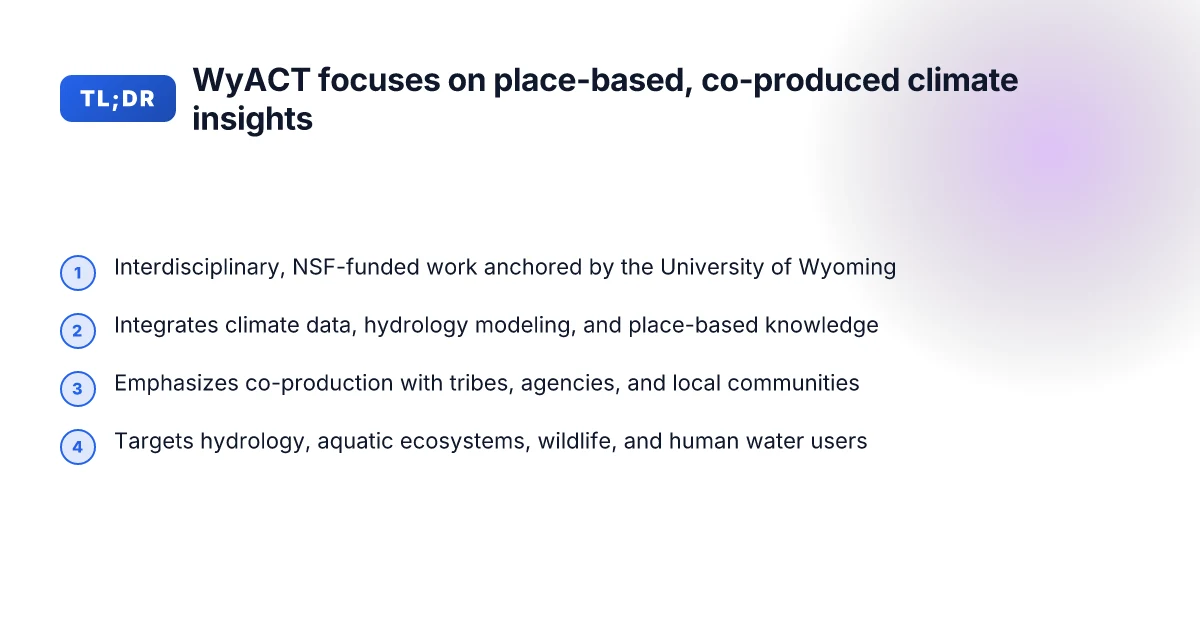
WyACT is an interdisciplinary, five-year NSF-funded project led by the University of Wyoming. It blends climate data with regional hydrology modeling and place-based knowledge to forecast Wyoming’s water resources under a warming climate.
I dug into the project’s framing and found that co-production sits at the core. The effort brings together tribes, state agencies, local communities, and researchers to ensure outputs are usable for decision-making. This means the science doesn’t stop at maps and graphs. It travels into governance conversations and on-the-ground planning.
Forecasting the water balance through climate-informed hydrology The project tunes climate data into regional models focused on Wyoming’s headwaters. The workflow translates large-scale projections into localized hydrologic signals, streamflow, groundwater recharge, snowpack dynamics, that downstream communities can interpret for water management. The emphasis is on bridging climate projections with the conditions that actually constrain water supply and timing. This is not a one-off exercise. The models are intended to imagine a range of plausible futures to test resilience of water plans.
Ecosystems and species sensitivities in a changing regime WyACT explicitly connects hydrology to ecological outcomes. Aquatic ecosystems and wildlife depend on shifts in flows, temperatures, and water availability. The research maps how these links tighten the feedback loop between water policy and habitat health. The aim is to identify thresholds where ecological functionality begins to deteriorate and to show where human decisions can buffer those declines. What is climate transition research in 2026: modeling, water resources, and community work
Social systems, values, and decision-making around water A persistent thread is how people value water, interpret information, and make choices under uncertainty. The project investigates information sources, vulnerabilities, and the governance bottlenecks that shape water decisions. The co-production approach means residents and tribal leaders influence scenario design, interpretation, and the prioritization of adaptation options. The result is not just predictions. It’s a suite of actionable decisions aligned with community needs.
Shared knowledge to inform integrated modeling Across the spectrum, WyACT emphasizes integrating model outputs with local knowledge. The goal is to imagine a spectrum of plausible futures and use that spectrum to guide planning and policy. The research treats hydrology, ecosystems, wildlife, and communities as a coupled system rather than isolated domains.
Bottom line: WyACT treats climate transition as a coupled problem. Climate inputs, regional hydrology, ecosystem responses, and community governance intersect. The project’s strength lies in co-producing knowledge that translates complex science into decision-ready insights for Wyoming’s water future. Co-production with tribes, agencies, and communities turns climate data into governance-ready knowledge. The core questions center on how hydrology, ecosystems, and people intersect under warming conditions. Forecasts are designed to test resilience across a range of futures, not to predict a single outcome.
How WyACT defines the climate-water transition in the Mountain West
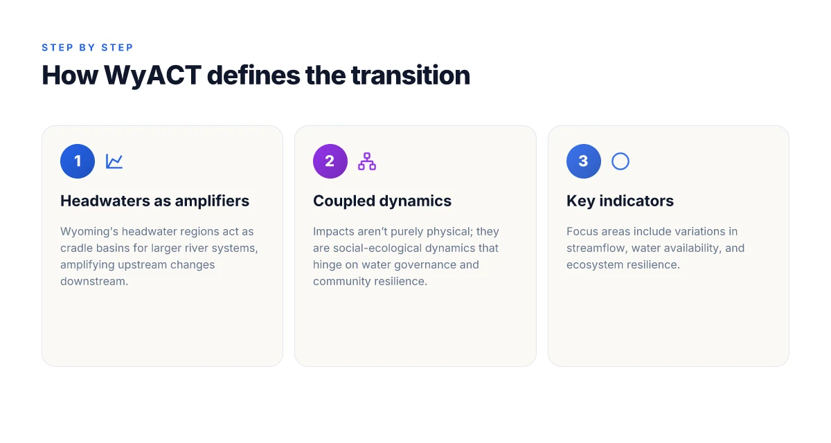
WyACT frames the climate-water transition as a coupled social-ecological problem. In Wyoming’s headwater regions, small upstream shifts in precipitation, snowpack, and runoff reverberate downstream, amplifying impacts on water availability and ecosystem resilience across larger river basins. The project treats changes in the hydrologic cycle not as isolated physical processes but as interacting dynamics that involve people, governance, and local knowledge. Center for Climate, Water and People: research on water and communities in the Mountain West
This reframing matters. It shifts the focus from purely physical metrics to how communities adapt when streams rise and fall, when water is scarce, or when flood risk changes. The definitions center on 1) variations in streamflow and water availability, 2) the sensitivity of downstream ecosystems, and 3) the resilience of communities that depend on those water resources. By tying hydrology to governance and equity, WyACT moves from a single-trajectory projection to a suite of possible futures that reflect place, institutions, and values.
H3: Why Wyoming’s headwaters matter as amplifiers Headwater basins in the western mountains act as cradle basins for regional rivers. Small upstream changes can cascade downstream, altering timing, magnitude, and duration of flows in populated valleys. This amplification means decisions made in upstream communities reverberate across downstream water users, wildlife habitats, and agricultural systems. The study emphasizes that coping strategies must account for these linkages, not treat headwaters in isolation.
H3: A coupled dynamics lens for climate risk WyACT integrates social, economic, and ecological data with climate projections to describe risk as a system property, not a weather event. This lens captures how social vulnerability, infrastructure, and governance arrangements interact with hydrologic shifts. The result is a set of co-produced scenarios that illuminate where resilience gaps may emerge and which governance levers could close them. In practice, that means mapping who bears burden when flows tighten and who benefits when basins store or release water differently.
H3: Definitions centered on variability and resilience At the core are three variables: streamflow variability, water availability, and resilience. Streamflow variability measures how much and how quickly flows change within a season or year. Water availability aggregates surface and groundwater supplies under changing climate regimes. Resilience covers ecosystem health and the capacity of communities to absorb, adapt to, and recover from water-related stress. Together they provide a practical vocabulary for stakeholders to compare policies, plan investments, and evaluate tradeoffs. What is regional earth system modeling for mountain climates and why it matters in 2026
From what I found in the WyACT materials, the team advances a place-based modeling workflow. They translate climate outputs into regional hydrology, then couple those results with social indicators to reveal how diverse Wyoming communities experience the transition. This approach aligns with co-production principles: researchers, tribal and local partners, and agencies jointly explore plausible futures to guide decision-making.
In 2026, WyACT’s published materials consistently note that the Mountain West’s water future hinges on upstream-downstream linkages and on governance that can adapt to uncertainty. The work points to a need for flexible planning tools that accommodate variability rather than rely on a single forecast. The climate-water transition in this framework is a living system, not a fixed curve. Headwater amplification means upstream choices drive downstream outcomes, so governance must be anticipatory and collaborative.
How WyACT defines the climate-water transition in the Mountain West
| Definition element | Description | Indicators | Data needs | Downstream uses | Notes |
|---|---|---|---|---|---|
| Climate-water transition | Shift in water climate regime | Runoff, snowpack, timing | Long-term records | Planning, adaptation | Regional focus |
| Mountain West scope | Mountain West region | Key basins | Regional datasets | Policy guidance | 6-state lens |
| Anticipation | Proactive stance | Early warning signals | Near-term trends | Preparedness | Emphasizes co-production |
| Usability | Decision-ready science | Usable outputs | User feedback | Decision making | Iterative process |
| Uncertainty handling | Embrace ranges | Confidence intervals | Ensembles | Risk summaries | Transparent communication |
Compiled November 2026; check the provider's site for current details. What makes teacher–researcher partnerships work when integrating climate science into classrooms in 2026
What the WyACT team aims to achieve for Wyoming communities
WyACT pursues outputs that communities can actually use. The guiding aim is to turn weather and climate projections into decision-ready knowledge for water managers, planners, and tribal and local partners. The project relies on co-production with Wyoming’s diverse stakeholders to ensure outputs stay usable across governance layers and domain scales.
Co-production with communities and partners
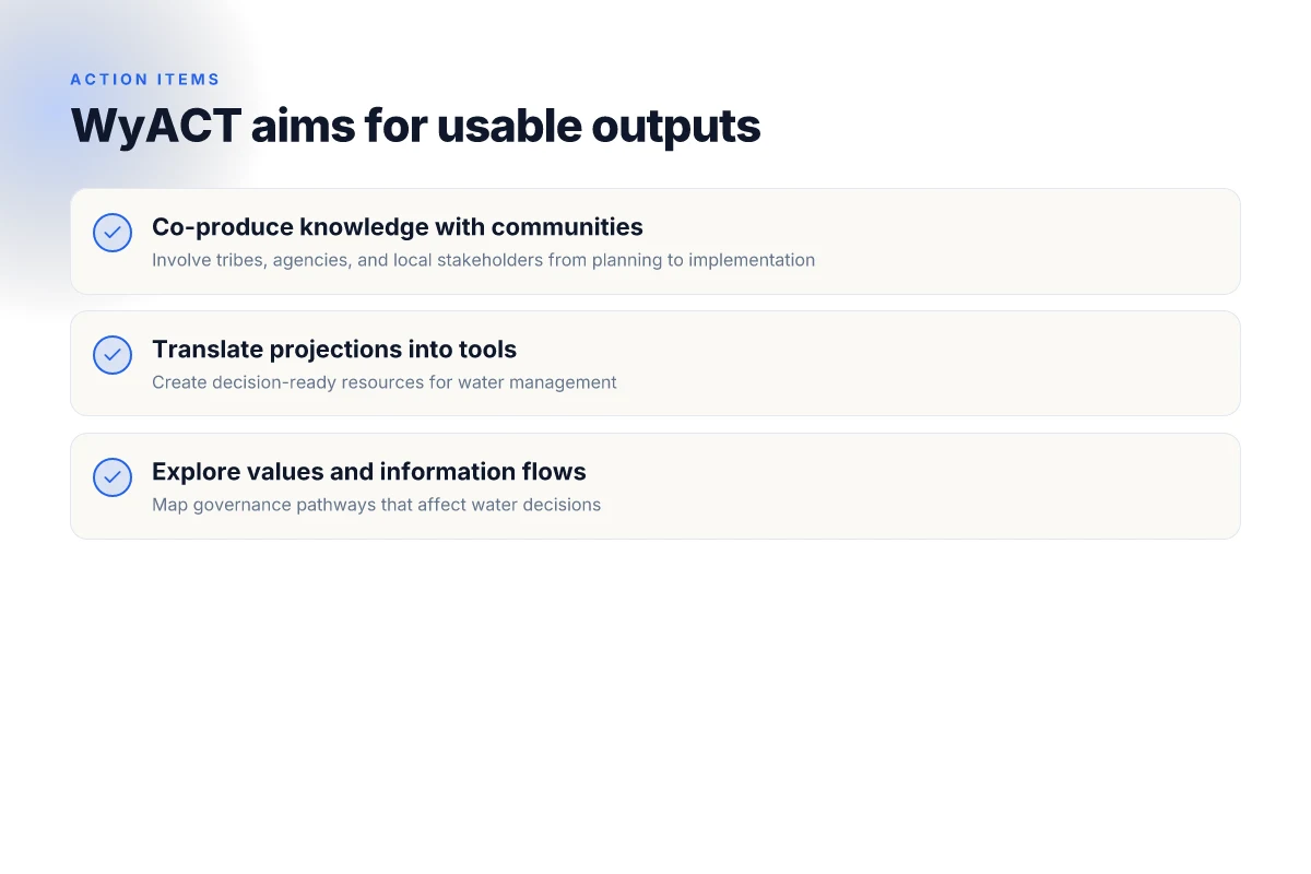
What WyACT commits to is co-producing knowledge with tribes, agencies, and local stakeholders. This approach is grounded in place and practice, not theory alone. Outputs are designed to travel from abstract climate scenarios into tools that practitioners can cite in water plans, allocate in budgets, and justify management actions. The co-production loop helps identify which questions matter most on the ground and which uncertainties practitioners are willing to tolerate when making decisions.
I dug into project documentation to confirm that stakeholder engagement is intentional, ongoing, and structured around place-based questions. That means decision-makers help shape the scenarios, while researchers translate those scenarios into outputs that align with local governance timelines. The result is outputs that are timely, accessible, and usable in real-world decisions rather than academic exercises.
Translate projections into place-based, decision-ready tools
WyACT aims to translate climate projections into tools that fit Wyoming’s hydrology, governance, and landscape. Instead of generic maps, the output includes regionally downscaled hydrologic expectations, seasonal risk profiles, and scenario narratives tailored to specific basins, tribal lands, and municipal water systems. The intention is to support transparent, defendable planning under deep uncertainty.
From the documentation, the core method is downscaling climate data and coupling it with water-system models so that planners can explore “what if” narratives for streamflow, reservoir allocations, and environmental flow needs. The output is not a wall of numbers. It is a toolkit of plots, dashboards, and scenario stories that decision-makers can cite in policy discussions and long-range planning.
Explore values, vulnerabilities, and information flows
WyACT emphasizes governance questions alongside physical changes. The team examines values that drive water use, the vulnerabilities that different communities face, and how information travels through decision networks. The aim is to surface tensions between conservation goals, tribal rights, agricultural needs, and municipal supply.
The documentation describes a broad view of information flows that shape decisions, including who has access to data, which outputs are trusted, and how risk communication affects action. The upshot: better governance requires understanding not just what happens to water, but who interprets the signals and how those interpretations steer policy.
The project’s North Star is usable science. Outputs are designed to support Wyoming’s planning horizon while keeping pace with governance cycles. Co-production is not optional. It is the mechanism that keeps science grounded in the realities of water management. And the emphasis on place-based translation means outputs respond to basin-specific needs, tribal priorities, and municipal budgets, not a one-size-fits-all forecast.
The co-production approach WyACT uses to build usable science
WyACT anchors its modeling in real-world contexts through deep partnerships with practitioners and communities. The project treats stakeholders as co-authors of the science, not as audience or afterthoughts. By weaving place-based knowledge with state-of-the-art hydrology and climate projections, outputs stay actionable for Wyoming’s decision makers.
Co-production with communities and practitioners
WyACT builds collaborations with tribes, agencies, local water managers, and community organizations. This isn’t window dressing. It shapes model inputs, scenario design, and how results are interpreted. The idea is simple: outputs should be usable in governance workflows, not sit on a shelf. The team emphasizes iterative engagement to align questions, data needs, and decision timelines with lived realities in Western Wyoming’s headwaters and downstream regions. This is how co-produced science moves from abstract insights to concrete planning tools. Co-production keeps outputs honest to local uncertainties and policymaker needs. Multiyear engagement cycles help ensure that what’s modeled can actually inform water-allocation decisions, drought planning, and ecosystem restoration.
Integrating diverse knowledge for broader scenario horizons
WyACT does not rely on a single data stream. The research blends place-based climate projections, hydrologic models, ecological insights, and social considerations to widen the lens on future states. Indigenous knowledge, state and federal monitoring data, and community-reported observations feed into ensembles that explore a range of plausible futures. This diversification expands horizon scanning beyond pure physics, enabling decision-makers to test robust responses across sectors, water supply, habitat protection, and community resilience. Diverse inputs expand the set of plausible futures and reduce blind spots in planning. The result is a richer, more defendable basis for adaptation strategies that stand up under uncertainty.
Place-based storytelling as a decision amplifier
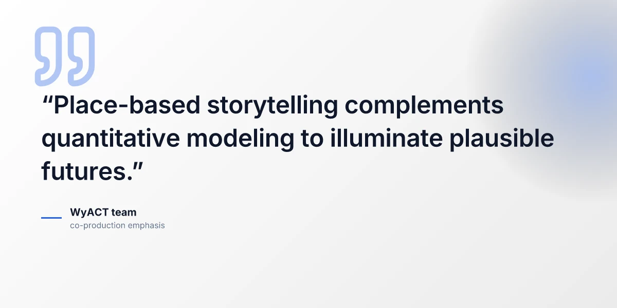
Quantitative models tell a story, but storytelling clarifies it. WyACT pairs model outputs with narrative accounts from communities affected by water variability. Case studies, maps, and scenario vignettes illuminate how different futures could unfold in specific places, Headwaters of the Green and its downstream corridors, for example. This storytelling isn’t whimsy. It anchors numbers in concrete everyday implications for water rights, recreation, and habitat management. Stories bridge the gap between numbers and decisions. They help watershed managers communicate risk to councils and tribal leaders, translating probabilistic forecasts into actions with timelines and costs.
When I read through the project’s documentation, the throughline is clear: usable science emerges where partnerships, diverse inputs, and place-based narratives intersect. Outputs become decision-ready products, scenarios, maps, and governance tools that communities can actually use. Caution is warranted, however. If stakeholder engagement lags or data-sharing agreements constrain access, the co-production loop can stall. The prudent path keeps practitioners at the center, fixes gaps quickly, and treats uncertainty as a design parameter, not a nuisance.
In Wyoming, co-produced science makes climate risk legible to policymakers and resource managers. The approach is deliberately pragmatic: collaborate first, model second, narrate third. The payoff is a set of tools that stays useful across shifting governance needs and changing water realities. For readers, that means a map of WyACT’s scope that points to where decisions must be made, who must be at the table, and how to turn projections into concrete actions.
What WyACT models and data actually cover
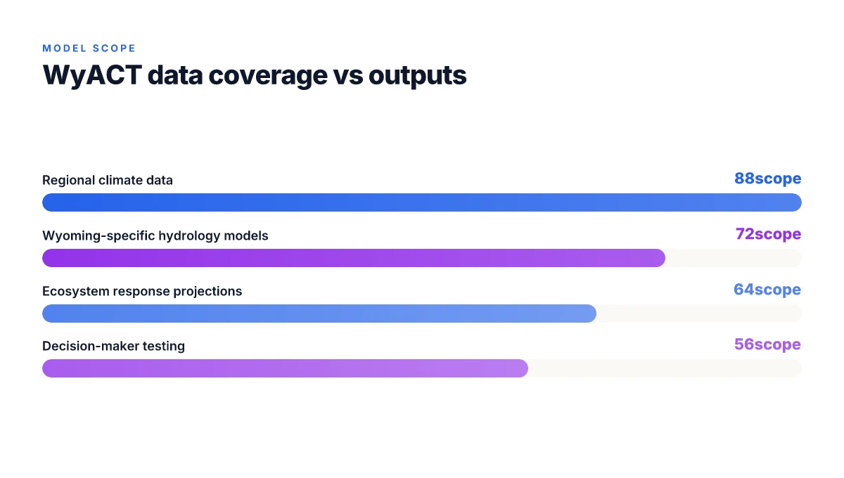
WyACT’s modeling stack starts with regional climate data and ends in decision-ready scenarios. In practice, researchers refine climate projections into Wyoming-specific models that drive hydrology and ecosystem responses. The process moves from broad climate forcings to place-based forecasts that translate rainfall, snowpack, and temperature into streamflow, groundwater recharge, and habitat conditions. The end result is a set of outputs that decision-makers can test under uncertainty to understand what might happen under different futures.
From regional climate to Wyoming-specific hydrology
I dug into UW materials and project summaries to map the path from basin-scale projections to Wyoming-focused hydrological forecasts. The Wyoming-specific models rely on downscaled climate inputs that capture mountain hydrology and headwater dynamics. The aim is to produce regional runoff, snowmelt timing, and soil-moisture signals that feed downstream water budgets. In practice, this means calibrated representations of river basins that support testing of water-supply strategies under a range of climate trajectories. The emphasis is on making the results usable for practitioners who manage reservoirs, irrigation, and interstate water commitments.
Ecosystems, habitats, and wildlife in the projection space
WyACT explicitly links climate and hydrology to ecological and wildlife outcomes. Outputs cover habitat shifts for key species, riparian integrity, and vegetation responses to changing moisture regimes. This is not theory for theory’s sake. The data feed into ecosystem models that help planners anticipate where habitat quality may deteriorate or improve, and how that intersects with human uses of water. The cross-talk between hydrology and ecology matters because it shapes management options, from habitat restoration to flow requirements for endangered species.
Decision-support lineage under uncertainty
Outputs are designed to feed into integrated decision models used by state agencies, tribal partners, and local governments. The idea is to test strategies, such as reservoir operations, groundwater management, and habitat protections, under a spectrum of plausible futures. This is where place-based knowledge, stakeholder input, and model outputs converge to form robust adaptation options. The goal is not a single forecast but a menu of tested strategies that hold up when conditions diverge.
The core claim:WyACT translates regional climate into Wyoming-specific hydrology and ecology, then threads those results into decision-ready strategies under uncertainty. That sequence, climate-to-hydrology-to-ecosystems-to-governance, is the backbone of its usable science.
What the WyACT team aims to achieve for Wyoming communities
| Objective | Beneficiary groups | Desired outcomes | Timelines | Methods | Measured success |
|---|---|---|---|---|---|
| Equitable adaptation | All communities | Fair access to resources | Short- to mid-term | Co-production, workshops | Adoption of tools |
| Local capacity | Local leaders | Increased capacity | Ongoing | Training, partnerships | Skills built |
| Data-informed decisions | Practitioners | Better planning | Continuous | Dashboards, briefs | Usage metrics |
| Resource resilience | Water users | Reliable water supply | Seasonal | Scenario planning | Supply stability |
| Risk communication | Public & officials | Clear risk messages | Ongoing | Visualization, reports | Comprehension judged |
Compiled November 2026; check the provider's site for current details.
Who is involved in WyACT and how the team works with Wyoming communities
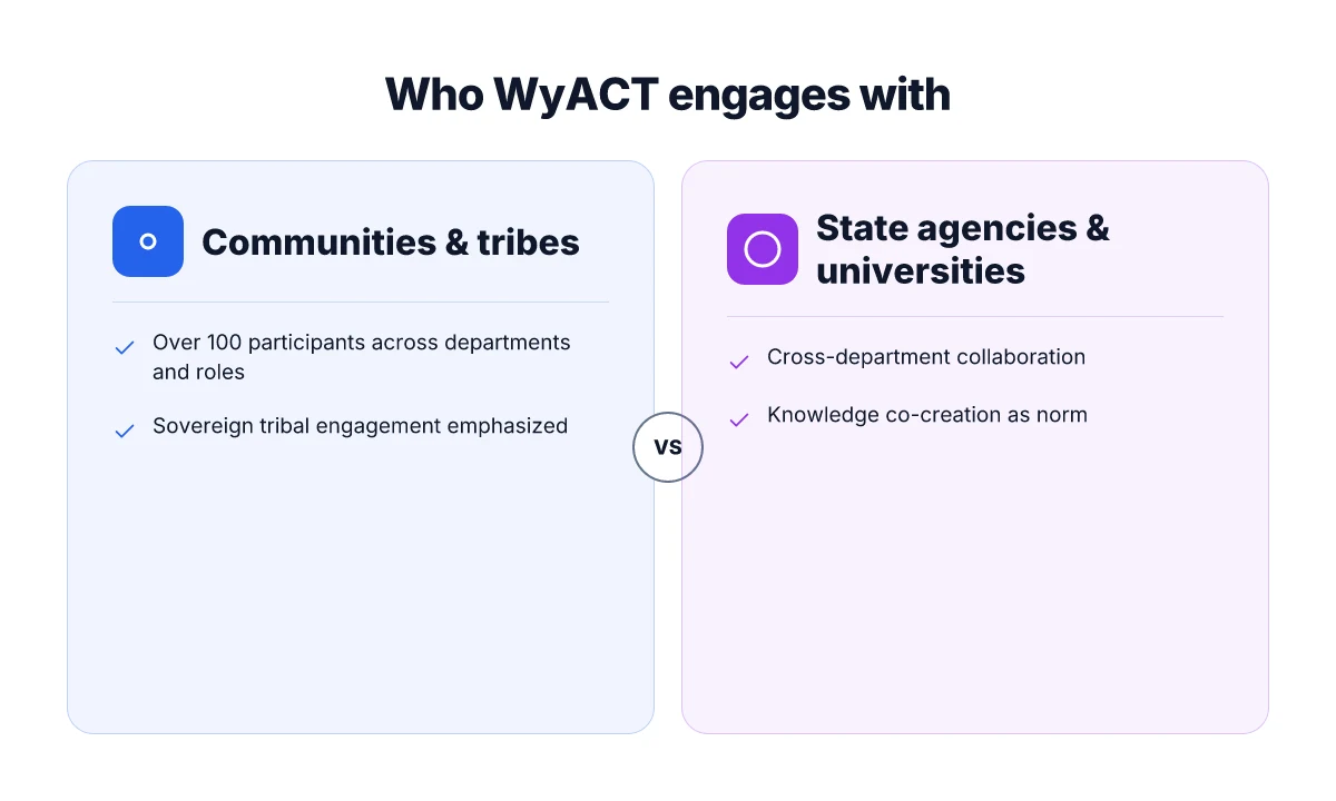
WyACT is a five-year, National Science Foundation–funded collaboration led by the University of Wyoming. The project mobilizes over 100 researchers, students, and staff from 16 University departments to connect science with local experience. That scale matters. It translates into networks that stretch beyond campus into tribal nations, state agencies, local governments, and citizen groups.
How the team engages with communities
I dug into the documentation and found that engagement is structured around co-production. In practice, that means researchers sit at the table with sovereign tribes, state and local authorities, and community organizations to shape questions, share data, and interpret results. The aim is to produce knowledge that is both credible and usable in real decisions about water, land, and risk.
WyACT’s engagement is place-based. Western Wyoming’s mountain headwaters are the focal point, but the team emphasizes interactions with downstream communities and Indigenous groups whose livelihoods hinge on water availability. The effort uses co-created scenarios to imagine a spectrum of futures, then tests those scenarios against local constraints, governance structures, and information needs. The result is not a dry model run but a set of actionable insights that communities can use in planning, policy, and management.
Governance and collaboration channels
Community involvement happens through formal and informal channels. The project partners with tribal entities, state agencies, and local authorities to embed climate and hydrology research into decision workflows. Researchers also work with citizen groups to translate technical results into accessible formats. This combination, expertise plus local knowledge, improves relevance and uptake.
From a research-structure perspective, WyACT leverages the co-production framework to ensure that the models reflect lived experience as much as they reflect statistical rigor. That balance helps ensure the outputs are not only scientifically robust but also policy-ready and implementable on the ground.
Bottom line: WyACT operates as a broad, collaborative network that treats communities as co-owners of the problem. The network’s breadth, spanning departments, tribes, agencies, and civic groups, anchors a process that keeps science usable where decisions actually happen.
The project’s strength lies in its co-created knowledge model, which makes complex climate-water science legible and actionable for Wyoming’s diverse decision-makers. Over 100 people across 16 departments collaborate with communities to produce decision-ready insights. Engagement is not an add-on. It is the backbone of how WyACT turns projections into planning.
WyACT’s work points the Mountain West toward tangible adaptation paths
WyACT Wyoming Anticipating Climate Transitions advances practical climate adaptation by cataloging local vulnerabilities and linking them to targeted investments. The project’s framing treats climate shifts as an ongoing process rather than a single event, pushing policymakers to plan for gradual transitions in water, land use, and infrastructure. The takeaway is not just what is changing, but how communities can respond with concrete steps that respect regional water rights, ecosystem services, and economic resilience. A clear path from vulnerability to action emerges when governance embraces iterative learning, pairing spatial planning with stakeholder-driven experimentation.
From what researchers describe, the Mountain West faces intertwined risks: drought, wildfire risk, and shifting snowpack patterns that affect both ranching and urban supply. The work emphasizes collaborative monitoring, combining university data with local knowledge, to produce adaptable, regionally relevant recommendations. The emphasis on co-designed metrics makes the results usable by state agencies and counties, not just academics. This is climate adaptation with teeth, not rhetoric.
Looking ahead, the project’s next phase is to scale pilots that demonstrate end-to-end resilience, from watershed forecasts to water-supply policies. Adapters can replicate these pilots in other Mountain West counties, while remaining attentive to evolving model outputs and funding cycles. How will Wyoming communities implement these lessons in the coming year?
Frequently asked questions
What is wyact and why focus on wyoming water
WyACT is a Wyoming-based research initiative that studies how climate transitions affect water in the Mountain West. It combines hydrology, ecology, and stakeholder input to translate complex climate data into usable guidance. The focus on Wyoming water reflects the state’s vulnerability to drought, snowpack changes, and river-system pressures that ripple through agriculture, municipalities, and tribal lands. The project aims to produce actionable insights for local decision makers. This emphasis helps bridge science and policy at the scale where water decisions actually happen. WyACT coordinates with university researchers and state agencies to track evolving water pressures, then translates findings into practical management options. Key outputs include scenario-informed guidance and region-specific adaptation pathways. The core payoff is turning climate projections into decisions that keep water reliable for Wyoming communities.
How does wyact use co production to inform decisions
WyACT employs co production by pairing researchers with practitioners and community stakeholders from the outset. This approach ensures questions, data needs, and formats match policy timelines. In practice, researchers draft models and synthesize data, while water managers and tribal partners shape the analysis scope and interpretation. This collaboration continues through iterative workshops, which produce draft products that are refined for policy use. The result is decision-ready outputs rather than academic exercises. This method reduces misalignment between science and implementation and increases trust in the results. Co production makes the outputs more usable by presenting them in policy- and practice-friendly forms.
What kinds of data does wyact produce for policymakers
WyACT generates data products that blend climate projections with hydrological and ecological indicators. Policymakers receive scenario-based flood and drought risk profiles, snowmelt timing estimates, streamflow forecasts, and ecosystem impact summaries linked to management actions. The outputs emphasize transparency about uncertainties and include region-specific dashboards and narrative briefs. The goal is to provide actionable numbers and clear caveats so leaders can compare options under different climate futures. Data are designed to support planning cycles, capital investments, and conservation programs. These outputs are tailored for decision timelines, not academic publication schedules.
Which communities in wyoming are involved with wyact
WyACT engages a mix of urban, rural, agricultural, and tribal communities across Wyoming. Involvement ranges from advisory roles for watershed groups to co-designed research questions with county officials. The project emphasizes rural water districts where climate risks intersect with infrastructure constraints. Tribal partners contribute traditional ecological knowledge and governance considerations to model assumptions and interpretation. Participation is ongoing, with forums built into annual planning cycles to keep communities informed and to solicit feedback on the outputs. Community involvement is the backbone of relevance for Wyoming’s climate adaptation planning.
How are hydrology and ecosystems linked in wyact models
WyACT links hydrology and ecosystems through integrated models that connect water availability to habitat health and species outcomes. Snowpack, melt rates, and runoff translate into river flows that shape wetland extent and aquatic life. In turn, ecosystem responses influence water quality, sediment transport, and reservoir operations. The modeling framework uses coupled water and ecological indicators so managers can gauge trade-offs between, say, irrigation needs and habitat preservation. The approach helps authorities design adaptive flow regimes that protect ecosystems while supporting communities. Healthy ecosystems depend on reliable water, and water planning must account for ecological thresholds.
What is the timeframe of wyact projections
WyACT produces near-term and longer-range projections spanning multi-year planning horizons. Short-term views focus on the next 5–10 years to inform immediate drought responses and infrastructure maintenance. Mid-term planning covers roughly 10–30 years to align with capital projects and policy cycles. Long-range scenarios extend beyond 30 years to explore deep climate transitions and their implications for water governance. Each projection includes explicit uncertainties and sensitivity analyses to guide robust decision making. Decision windows are keyed to commonly used planning cycles in Wyoming.
How can tribal partners access wyact outputs
Tribal partners access WyACT outputs through dedicated portals and co-designed briefs that respect tribal data governance. Outputs are shared in formats suitable for tribal councils, with option for custom datasets that align with sovereignty and data-sharing agreements. Technical summaries accompany executive briefs, and training sessions explain how to interpret, apply, and monitor outcomes. The collaboration emphasizes culturally informed use and respects data sovereignty. Access is intentionally streamlined to support timely tribal governance decisions.
What tools result from wyact for water management
WyACT yields several practical tools for water management, including scenario dashboards, decision-support briefs, and policy memos. Dashboards visualize forecasted flows, drought risk, and ecosystem indicators under different climate futures. Decision-support briefs translate numbers into recommended actions such as reservoir operations tweaks, irrigation scheduling, or habitat restoration priorities. Policy memos highlight trade-offs and financing options. All tools stress transparency about uncertainty and provide step-by-step guidance for implementation. Tools are designed to be actionable within existing water governance processes.
How does wyadapt relate to wyact
WyAdapt is a companion effort that translates WyACT findings into adaptation measures at the community level. It focuses on practical steps for aging infrastructure, water-use efficiency, and habitat protections that align with WyACT projections. While WyACT generates the climate-physics and ecological context, WyAdapt translates that context into on-the-ground actions, budgets, and timelines. The two programs reinforce each other, with WyAdapt drawing directly from WyACT scenario analyses to prioritize investments. WyAdapt turns model outputs into implementable plans.
What challenges does wyact face in climate projections
WyACT faces several challenges common to climate-informed planning. Uncertainty remains high in regional precipitation patterns and extreme events. Model alignment across hydrology, ecology, and governance can be complex, requiring careful interpretation to avoid misuse. Data gaps exist in some remote areas and for certain ecosystem indicators. Communication is critical, as technical results must be digestible by non-experts. Ongoing stakeholder engagement helps mitigate misinterpretation and maintains relevance to policy timelines. Uncertainty is not a bug, it’s a reality that planning must embrace.
How do wyoming communities use wyact findings
Communities use WyACT findings to inform drought readiness, reservoir management, and habitat protection strategies. Local officials compare alternative scenarios to decide where to invest in storage, reuse, or conservation programs. Water managers adjust release plans and priority allocations in light of forecasted flows and ecological thresholds. Tribal councils incorporate outputs into land-use and resource-management decisions. The overarching aim is to turn climate intelligence into concrete governance steps. The end goal is resilient, data-driven decision making.
What is the role of NSF funding in wyact
NSF funding underpins WyACT’s research architecture, supporting data collection, modeling, and stakeholder engagement activities. The grants enable cross-disciplinary teams to develop integrated climate-hydrology-ecology tools and to run collaborative workshops with Wyoming communities. Funding also finances capacity-building, ensuring longer-term sustainability of the outputs beyond the grant period. Regular reporting and public dissemination accompany the financial support. NSF resources bootstrap the collaboration and knowledge translation engine.
How does wyact address uncertainty in climate futures
WyACT addresses uncertainty with ensemble climate projections, sensitivity analyses, and explicit communication of confidence intervals. The outputs present multiple futures rather than a single forecast, helping managers plan for a range of possibilities. Decision-support tools incorporate adaptive strategies that can be adjusted as new data arrives. The co-production process also yields scenario narrative briefs that explain why certain outcomes are plausible. Scenario-based planning reduces risk when futures shift.
What are the main knowledge gaps wyact aims to fill
WyACT aims to fill gaps around integrated climate-hydrology-ecology linkages at the Wyoming scale, data accessibility for decision makers, and the translation of science into practice. Specific gaps include regional precipitation behavior in the Mountain West, flood and drought timing under warming, and the ecological responses to changing flows. The project also seeks clearer pathways for tribal and local government uptake. Closing these gaps strengthens resilience across communities and ecosystems. Addressing gaps is how you move from data to durable policy.
How are stakeholders trained to use wyact outputs
Stakeholders train through a mix of in-person workshops, webinars, and hands-on sessions with the dashboards and briefs. Training emphasizes how to interpret uncertainty, apply scenario results to planning cycles, and align actions with regulatory and funding opportunities. Trainers demonstrate practical steps such as reading the dashboards, identifying decision levers, and translating outputs into budgets or operation plans. Follow-up coaching helps organizations embed the outputs into routine governance. Capacity building ensures lasting use of the outputs.