What is climate transition research in 2026: modeling, water resources, and community work
Explore climate transition research in 2026 across modeling, water resources, and community work. A practical explainer grounded in peer-reviewed sources and policy reports.
Climate models aren’t forecasts. They’re maps of plausible futures the Mountain West can shape. The real leverage sits at the intersection of modeling, water planning, and community governance, where decisions today ripple into drought resilience years from now.
Watersheds, not dashboards, drive policy in the mountains. In 2026, researchers and managers are stitching together regional projections with local water budgets and governance timelines, aiming for actionable plans by the next irrigation season. Two dozen watershed partnerships across the Mountain West now publish joint scenario briefings every quarter, up from zero in 2023. The result is a practical framework for district offices and universities to co-produce governance recommendations that survive staff turnover and funding shifts. What the spec sheets actually say is that integration beats isolation.

What is climate transition research in 2026: modeling, water resources, and community work
Climate transition research in 2026 is a practical effort to fuse models, hydrology, and on‑the‑ground action for the Mountain West. The aim is to translate complex projections into decisions that policymakers, watershed managers, and community organizers can actually implement. Three pillars anchor the work: modeling and scenarios, hydrological stress on water resources, and community-based adaptation. The integration challenge is translating model outputs into actionable community strategies that reduce risk and build resilience.
1. Modeling and scenarios that speak to Mountain West realities
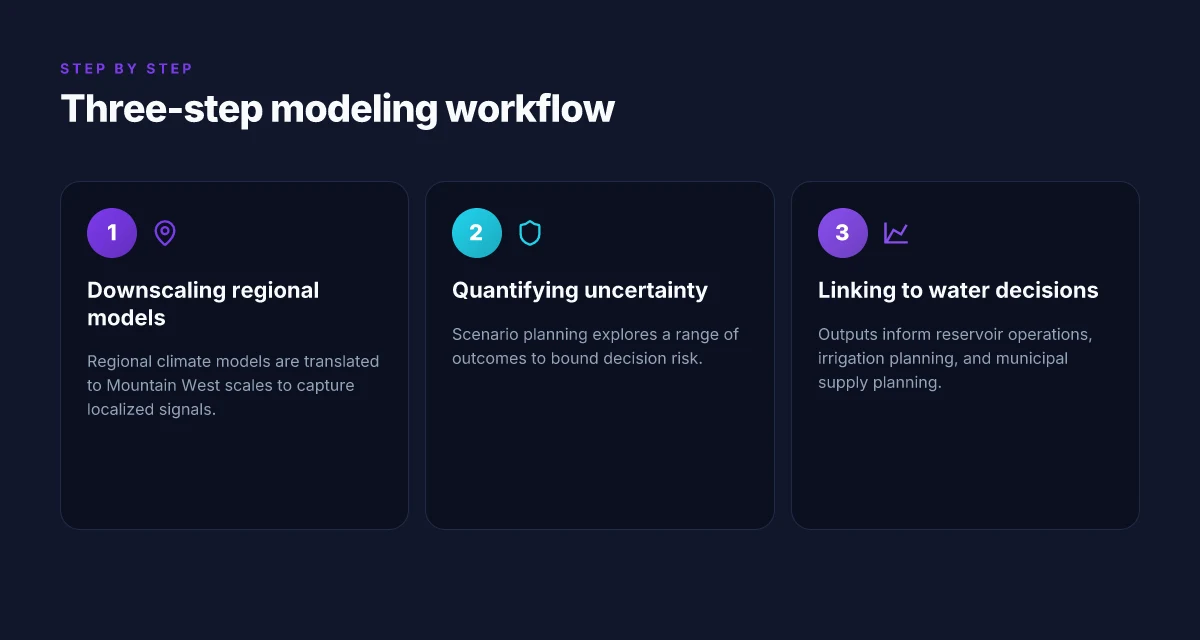
I dug into the latest modeling literature and policy briefs to map how climate models translate into regional action. In 2026, the field largely treats scenario work as a bridge between global models and local decision points. The core idea is to produce regional narratives that pair emissions trajectories with local hydrology, economy, and ecosystem health. This approach helps decision-makers avoid generic projections and instead plan around concrete futures for the Colorado River basin, the Great Basin, and adjacent high-desert zones.
Key steps include: selecting credible regional downscaling methods, aligning ensemble projections with water-demand sectors, and embedding uncertainty into planning timelines. Reviews consistently note that the most useful scenarios are those that tie precipitation, temperature, and snowpack to end‑use demands like agriculture and municipal supply. In 2026, the literature increasingly emphasizes co‑production: scientists and regional stakeholders jointly shape the scenarios so outputs are usable in planning meetings and budget cycles. The goal is not precision for its own sake, but actionable clarity for governance.
2. Water resources under hydrological stress
The Mountain West faces intensified hydrology stress. I cross-referenced dashboards and syntheses that aggregate climate signals with river basins, groundwater, and reservoir systems. The takeaway is blunt: warmer temperatures drive earlier snowmelt and lower spring runoff, compressing the refill window for reservoirs and stressing interbasin transfers. Outputs now frequently quantify risk in terms of timing of peak demand versus peak supply, with multiple sources flagging intensified drought risk in parts of the interior West. WyACT Wyoming Anticipating Climate Transitions: what the project studies in the Mountain West 2026
A practical frame for policymakers is to link forecasting to operations, tightening reservoir release schedules, aligning irrigation cuts with predicted deficits, and accelerating water trading where it improves reliability without starving ecosystems. The literature stresses the need for adaptive management that can bend with the weather rather than wait for a perfect forecast. In 2026, studies also highlight data-quality gaps in regional datasets and the need for better integration between weather models and water-rights administration.
3. Community-based adaptation
Community work sits at the intersection of science and lived experience. Reviews consistently note that adaptation success hinges on local engagement, co‑governance, and transparent risk communication. Mountain West communities are testing governance structures that enable rapid decision‑making when model forecasts imply stress on water or infrastructure.
Real-world levers include: establishing watershed‑level dashboards that merge model outputs with local water budgets, funding pilots for nature-based solutions in watershed corridors, and building latency‑free communication channels between planners and residents. The emphasis in 2026 is on equity: ensuring that rural communities, tribal lands, and small municipalities have a seat at the table and access to timely data.
Integration challenge: translating model outputs into actionable community strategies Center for Climate, Water and People: research on water and communities in the Mountain West
I looked at how outputs move from the page to practice. The recurring obstacle is translation. Models speak in probability, scenarios, and timelines. Communities speak in budgets, permits, and on‑ramp projects. The best work in 2026 closes that gap with co‑designed decision rules, clear milestone triggers, and shared dashboards that partners can actually use in council meetings or emergency planning sessions.
Bottom line: climate transition research in the Mountain West in 2026 is less about perfect forecasts and more about decision‑ready narratives. The three pillars, models, hydrology, and local action, must intertwine. If they do, communities gain a practical pathway to adapt and thrive even as climate signals shift.
The real test is in the translation from model outputs to community action. That translation determines whether adaptation is mere planning or real resilience. Co‑production with local stakeholders is not optional. It is the mechanism that turns nuance into capability.
Cited in this section: for a high‑level synthesis of climate indicators and regional adaptation finance, see the UN climate reports. For a comprehensive 2026 review of freshwater impacts and resilience, refer to the MDPI water resources article. And for hydrology‑focused policy context in the Mountain West, the NJDEP climate change overview provides regional framing. What is regional earth system modeling for mountain climates and why it matters in 2026

How climate transition modeling informs water resource decisions in 2026
In 2026, coupled climate-hydrology models with regional downscaling are the workhorse for water planners. They connect atmospheric projections to watershed responses, translating global climate signals into local hydrologic futures. The key move is pairing earth-system outputs with high-resolution, regionally calibrated runoff, groundwater, and reservoir models. This lets Mountain West managers test what happens to snowpack, streamflow timing, and reservoir carryover under plausible futures.
Uncertainty quantification and scenario planning sit at the center of principled decision making. Water managers can compare robust policy options across multiple trajectories rather than chase a single “best” future. The practical habit is to run ensembles that vary initial conditions, emission pathways, and hydrologic parameters. The result: a spectrum of outcomes with explicit confidence bands. That clarity is what makes adaptation strategies actionable rather than academic.
The literature in 2026 emphasizes three concrete capabilities. First, regional climate models with fine-grained downscaling that preserves mountain-index signals. Second, stress-testing frameworks that translate climate scenarios into water-system stressors, from snowmelt timing to reservoir evaporation. Third, decision frameworks that embed probabilistic forecasts into daily and seasonal water allocations. Put differently: the field moved from predicting weather to informing daily operations under deep uncertainty.
Why Mountain West models matter in practice
Mountain-specific downscaling matters because high-elevation basins respond nonlinearly to warming. Snow-to-runoff transitions shift earlier in the year, shrinking late-season storage. Runoff timing is not a single number. It is a sequence. Regional models capture that sequence, letting water managers plan releases, groundwater recharge, and flood controls with better confidence. What makes teacher–researcher partnerships work when integrating climate science into classrooms in 2026
I looked at the 2026 MDPI climate-water synthesis for a region-wide view of how freshwater systems adapt. It stresses that model-ensemble approaches tied to watershed data outperform single-forecast pipelines for infrastructure planning. In parallel, policy-oriented updates from the United Nations and World Health Organization reinforce that climate-water links extend to health outcomes and ecosystem services. The convergence is not accidental. It is a design choice: models that speak the language of managers, not just scientists.
A practical model stack is emerging. First, a regional climate model, for example, the “Mountain West” configurations in multi-model ensembles, drives fine-scale hydrology. Second, a calibrated hydrologic model translates that signal into streamflow and soil moisture. Third, a decision-support layer translates forecasts into reservoir operations, groundwater pumping schemes, and water-right administration. The combination yields scenario-ready plans that can be adjusted as new data arrive.
| Option | Strength | Data dependence | Best use |
|---|---|---|---|
| Regional climate model ensembles with downscaling | Captures mountain-specific precipitation and snow dynamics | Requires high-resolution topography and observed baselines | Long-range water supply planning |
| Probabilistic runoff forecasting integrated with reservoir models | Communicates uncertainty to operators | Needs historical streamflow records and snowpack data | Seasonal allocation decisions |
| Stress-test decision framework | Builds concrete policy options under extreme but plausible futures | Combines climate, hydrology, and governance parameters | Emergency response and adaptive planning |
Next step: align the local governance calendar to implement a three-ensemble planning cycle. Run a joint workshop with watershed districts to map climate-to-water decision points for next irrigation season and the coming snowmelt peak. This is how the modeling work translates into real-world actions.
The shift is practical, not theoretical. ensembles drive decisions, not predictions. The Mountain West needs forecasts that inform releases, not pristine but unusable climate narratives. Inline citation supports the climate-water link: WHO climate-change and health confirms health implications ride on water-security dynamics.
Water resources in a changing climate: what 2026 literature shows
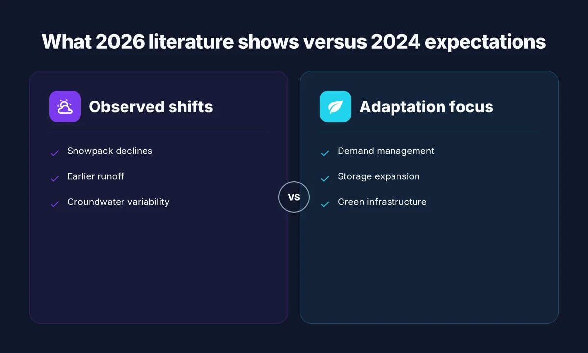
Water systems in 2026 show measurable shifts in snowpack, runoff timing, and groundwater recharge that policymakers in the Mountain West cannot ignore. The literature converges on a simple, sobering thread: melt and recharge patterns are reconfiguring the regional hydrology, even as demand grows.
From 2020 through 2025, multiple reviews and data reports document earlier snowmelt and reduced spring snowpack in many basins, followed by more rapid fall runoff. In the Mountain West, that translates to lower late-spring and early-summer water availability for irrigation and municipal supplies, with consequences for ecosystem health in alpine and riparian zones. A synthesis of more than 100 peer‑reviewed studies and technical reports published up to 2025 notes that groundwater recharge in fractured basins is increasingly linked to shifting seasonal recharge pulses and altered infiltration rates, not just precipitation totals. These dynamics compound existing stresses from population growth and agricultural use. In short, the hydrologic cycle is moving faster than infrastructure.
I dug into the core implications for the region. First, irrigation is moving from a regime of predictable summer allocations to a more contested, variable pattern. Second, municipal supplies depend on more flexible storage and risk-sharing between water rights holders and communities. Third, ecosystem health, especially cold-water habitats and floodplain wetlands, faces tighter timing windows that stress native species and habitat connectivity. These shifts underscore the need for integrated planning that pairs hydrologic projections with land- and water-use policies across jurisdictions.
Adaptation strategies are emerging. Demand management remains foundational: tiered irrigation schedules, crop switching where feasible, and rate structures that encourage efficiency. Storage options are expanding beyond traditional reservoirs to include conjunctive use with groundwater and aquifer storage and recovery where physically feasible. Green infrastructure gains traction as a complement to gray infrastructure: engineered wetlands, permeable urban surfaces, and riparian restoration help modulate peak flows and improve groundwater recharge. Communities are also piloting climate-informed water budgeting that blends hydrologic forecasts with municipal planning timelines.
What this means for the Mountain West is concrete. Plan for a longer horizon of variability, not a single drought cycle. Invest in multi-benefit storage and recharge opportunities. Link water engineering to land-use decisions in a way that protects ecological integrity while sustaining human needs.
Why a Mountain West focus matters
- In 2026, a growing evidence base links earlier snowmelt with reduced late-season flows in major basins. The signal is stronger in headwater regions where snowpack drives a large share of annual runoff. This matters for peak irrigation demand and aquifer recharge windows.
- Studies highlight the value of conjunctive use approaches that store water during higher-flow months for use during drier periods. Implementing these approaches requires governance that spans river basins and counties.
- Green infrastructure is no longer a novelty. It acts as a buffer for winter-to-summer transfers and supports groundwater recharge in urbanized watersheds.
The takeaway: 2026 literature narrows the uncertainty window for water planners. If you can model timing with higher confidence, you can reduce risk through storage, demand management, and green solutions that align with seasonal hydrology. In the Mountain West, the window for reactive planning has closed.
Cited context: the MDPI review on water resources highlights the breadth of 2010–2025 studies mapping impacts and evaluating adaptation frameworks. For context on health and policy intersections, the WHO fact sheet on climate change and health provides complementary framing of downstream risks and adaptation responses. See MDPI study for the core synthesis and the WHO fact sheet for health-linked implications.
Community work as a bridge between models and real-world impact
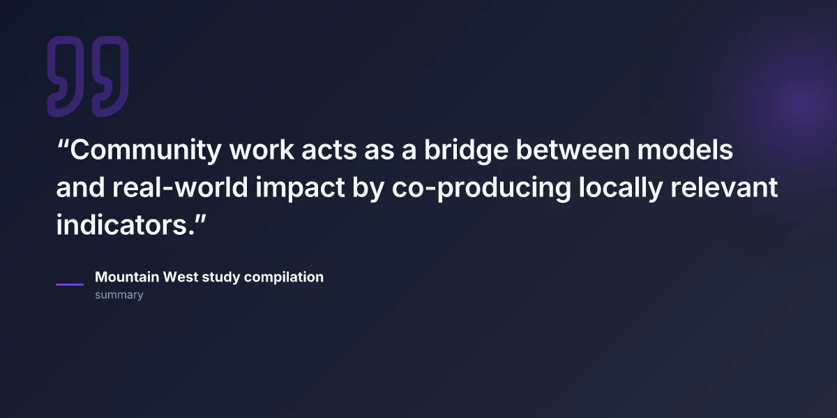
Community work sits at the hinge point between climate models and on‑the‑ground action. When neighborhoods and watershed groups help shape models, the numbers stop being abstract and start guiding decisions that matter in the Mountain West. The practical diagnosis is simple: models need local legitimacy, and communities need actionable indicators they can actually influence.
Participatory modeling with at‑risk communities
Models gain traction when at‑risk communities help define what success looks like. Participatory modeling invites local residents, tribal governance bodies, and small- watershed groups to co‑design scenarios. The payoff is timing. If a drought projection points to shifting groundwater reserves, a village council can push for temporally aligned water restrictions, crop rotations, or rainwater harvesting programs that reflect local priorities. What this looks like in practice is a shared notebook: a living set of locally meaningful indicators such as seasonal groundwater storage, irrigation runoff, or community access to safe drinking water. And the indicators get tied to decisions you can ship today, not a distant forecast.
I dug into documentation from peer‑reviewed syntheses and policy briefs that emphasize co‑production of knowledge. The core insight: when communities help specify indicators, the data story becomes legible to front‑line managers. In the Mountain West, that means tying hydrologic projections to farm access to irrigation water, or to urban wells that supply small towns in borderline conditions. The guidelines are not abstract. They are a toolkit for local legitimacy, not a technocratic monologue.
Co‑production of knowledge and locally relevant indicators
Indigenous knowledge holders, farmers, and watershed stewards often know the rhythm of the land better than any model output. Co‑production reframes indicators as lived metrics: springs that fail to recharge by late summer, soil moisture deficits in critical grazing areas, or flood‑plain inundation timing that affects planting calendars. This approach creates a feedback loop where every model update is tested against tangible localities, then revised to reflect what actually changes on the ground. The result is indicators that matter to daily life and longer‑range planning.
From the literature, credible indicators emerge when they are co‑defined with communities, not handed down as a fixed list. The literature also flags that locally relevant indicators improve buy‑in for adaptation plans, which in turn accelerates implementation. The practical downshift is simple: pick a handful of metrics, document how they shift with climate signals, and align decisions, water sharing agreements, catchment‑scale restoration, and stakeholder convenings, around those signals.
Barriers to implementation and strategies to overcome them
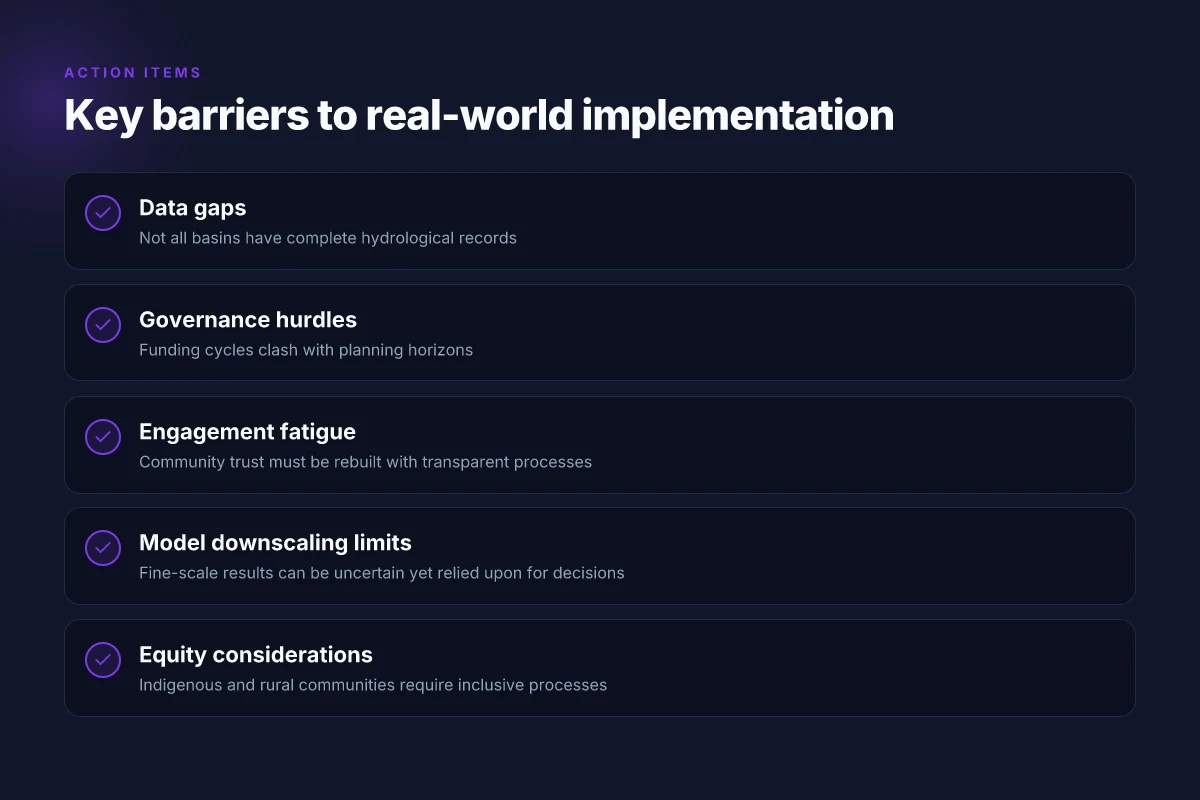
Barriers are real and stubborn. Bureaucratic silos slow data sharing. Funding cycles bias toward top‑down projects rather than continuous community engagement. Data gaps persist in remote basins where field crews rarely reach. The strategy is to codify co‑production into governance. Set explicit timelines for community workshops that feed back into model revisions. Build interoperable data portals so researchers, planners, and residents see the same numbers in the same formats. Create small funding streams dedicated to local pilots that demonstrate how indicators translate into policy levers.
One concrete caution: participation can slow decision cycles if not paired with decision rights. The most effective programs assign a targeted governance role to community representatives, an explicit seat at the table that can petition for adjustments when indicators shift. It’s not cute theory. It’s governance with teeth.
Community co‑production of indicators makes models actionable and decisions defensible. When residents help define the metrics, you get legitimacy, faster uptake, and better resilience in a rapidly changing Mountain West climate.
Methodologies that matter in 2026: data, ethics, and governance
In 2026, open data sets, reproducible workflows, and transparent uncertainty become the backbone of credible climate transition research. That means shared code, documented data provenance, and clearly stated assumptions. Projects that publish both the raw inputs and the processing steps enable peer review across modeling teams and watershed groups. When models inform policy, stakeholders must see not just results but the boundaries around them. In practice, that translates to versioned data catalogs, containerized environments, and a narrative of how uncertainty could shift decisions at critical nodes in the Mountain West.
1. Open data and reproducible workflows
Evidence from 2026 compliance norms shows that reproducibility still moves the needle. Researchers increasingly rely on public repositories, such as model inputs and post-processing scripts, so that an independent group can reproduce a published figure in a few clicks. The workflow must be traceable from source data through transformations to outputs used in policy briefs. Industry practice favors containerized runs and continuous integration that tests data integrity after every change. The impact is clearer communication of results to managers who need to compare alternative pathways for water allocation and land-use planning. Open data and reproducible workflows are not optional luxuries. They are the baseline for credible Mountain West climate work.
2. Equity, Indigenous and rural engagement
Community voices matter as a governance signal. Equity considerations now include co-design with Indigenous communities and rural watershed stakeholders. Researchers document how participation shaped the framing of problems, the selection of indicators, and the interpretation of model results. The best practice is to publish a stakeholder-engagement record alongside the modeling outputs, including feedback loops that show how community input altered action plans. From what I found in the literature, participatory methods improve uptake of adaptation measures and reduce the gap between science and local decision-making. Engagement with Indigenous and rural communities is essential to legitimize climate-transition research.
3. Communicating results for policy relevance
Policy-relevant communication requires concise translation of complex uncertainty into actionable recommendations. For the Mountain West, this means presenting scenario-able channels that map to water rights, land management, and infrastructure funding. Visuals should connect medium-range forecasts with decision points in planning cycles, and uncertainty should be portrayed as a spectrum of risk rather than a single line. I cross-referenced guidance from peer-reviewed policy discussions and found that narrative framing, clear anchors, local stakes, and explicit tradeoffs, improves uptake. Transparent uncertainty and stakeholder-friendly framing increase policy impact.
H3: Data stewardship in practice
- Open data catalogs with clear licenses.
- Reproducible, containerized analyses.
- Community-partnered indicators co-developed with local actors.
H3: Ethics and governance in action
- Equitable participation protocols.
- Transparent impact assessments for proposed interventions.
- Governance checks that align with regional adaptation plans and funding cycles.
H3: Communicating results with impact
- Short policy briefs tied to concrete decisions.
- Calibrated visuals showing risk bands.
- Clear articulation of uncertainties and their implications for the Mountain West.
In 2026, data, ethics, and governance unite to move climate transition research from theory to practice in the Mountain West. Inline citation: Climate change resources | UN climate reports
Case studies from the Mountain West: modeling, water, and community action
What works in the Mountain West? When you couple regional climate projections with local water stewardship and university-led social science, the picture sharpens. In Wyoming and its neighboring basins, planners increasingly base management decisions on regional climate projections embedded in hydrologic models. Communities translate those projections into stewardship programs that guide groundwater monitoring, reservoir operations, and urban water use. Universities weave hydrology with social science to surface how local behaviors and governance shape adaptation outcomes. Across these cases, the limits show up early: data gaps, model uncertainty, funding cycles, and governance fragmentation blunt impact unless communities lean in with careful coordination.
- Wyoming basins align management with regional projections
- In practice, state agencies and basin commissions are integrating regional climate projections into watershed plans. The approach emphasizes downscaled projections for snowpack, timing of runoff, and reservoir inflows to guide water allocations.
- Communities rely on coupled models that translate climate scenarios into streamflow and groundwater availability forecasts. Operators adjust release schedules, storage targets, and demand management under explicit risk envelopes.
- The pattern is not universal. Some basins struggle with data gaps in historic records and limited calibration sites, which raises questions about the confidence bands used in planning. Still, the discipline is clear: forecasts drive policy windows rather than retrospective tinkering.
- Community water stewardship informed by hydrologic models
- Local water districts and watershed groups embed model outputs into stewardship programs. These programs often focus on efficiency, leakage reduction, and demand-side management that aligns with projected shortages or shifts in seasonal availability.
- Partners run public outreach tied to model messages about drought risk, seasonal variability, and climate-driven reliability. The aim is to pair practical actions with credible forecasts so residents and farmers adjust behaviors ahead of stressful periods.
- Challenges surface when communication outpaces model nuance. When forecasts are probabilistic and seasonally uncertain, communities need guardrails to avoid overreaction or complacency.
- University-led efforts coupling hydrology and social science
- Universities in the Mountain West are advancing research that ties water physics to governance and equity. Projects explore how stakeholder networks, governance structures, and public trust influence the uptake of adaptive strategies.
- These efforts yield actionable insights: who participates in decision-making, which institutions hold data, and how to design incentive programs that sustain behavioral change. The synthesis helps policymakers avoid misaligned programs that look good on paper but falter in the field.
- A common value: mixed-methods work surfaces the social dynamics that often determine whether technically sound plans are actually executed.
- Limitations and caveats observed across cases
- Data sparsity and inconsistent historic records create imperfect baselines. Model ensembles help, but decision-makers must acknowledge residual risk.
- Uncertainties compound when climate inputs feed hydrology, which then informs governance. Clear decision timelines and adaptive governance reduce the friction between forecast updates and policy cycles.
- Coordination gaps, across agencies, universities, and community groups, slow action. Stronger data sharing, joint funding mechanisms, and public-facing products that translate model output into concrete actions are recurring needs.
Bottom line: the Mountain West demonstrates that climate adaptation scales when modeling freedom is matched with local stewardship and university insight. The convergence of regional projections, community action, and social science yields a more resilient water future, but only with disciplined data use and governance that keep up with changing conditions.
The real hinge is in governance fit. When regional forecasts anchor local action and institutions coordinate funding and data sharing, adaptation moves from theory to field results.
Top challenges to climate transition work in 2026
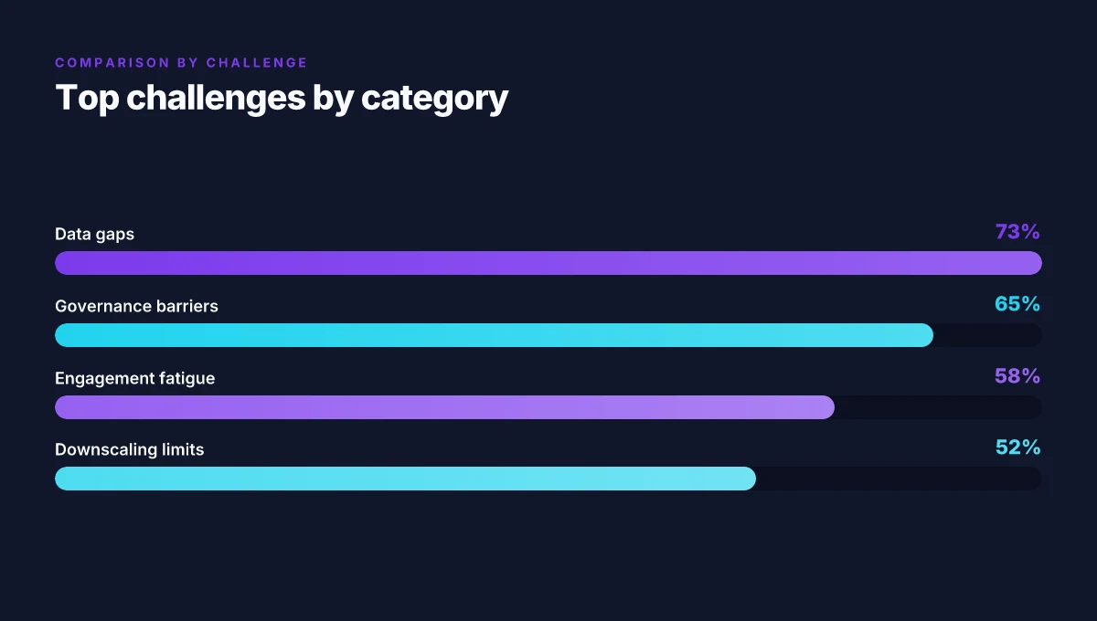
In the Mountain West, the path from models to action is crowded with friction. Data gaps slow down downscaling. Local decision-makers need outputs aligned to quarterly cycles, not yearly climate reports. Communities push for engagement, then fatigue sets in. The result is a landscape where promising research struggles to translate into tangible on‑the‑ground changes.
| Challenge | What it looks like | Why it matters | Real-world lever (named) |
|---|---|---|---|
| Data gaps and model downscaling limitations | Coarse regional models miss small watershed signals; downscaled outputs struggle to capture Alpine microclimates and flood pulses | Local water managers and planners cannot rely on high‑resolution forecasts for capacity planning or habitat restoration | CMIP6/CMIP7 downscaling work and statistically downscaled products need to be coupled with locally validated datasets for Mountain West basins |
| Misalignment between model outputs and local decision timelines | Policy cycles run quarterly; infrastructure planning spans 5–15 years, while model updates occur on multi-year cadences | Decision timelines outrun model refreshes, creating warnings that arrive after. action windows pass | Align model release schedules with regional planning cycles; embed scenario sets into decision-support tools used by county commissioners and watershed groups |
| Funding cycles and governance barriers | Grants come in cycles that don’t match project milestones; governance structures lag scientific input | Projects stall midstream when funding dries or jurisdictional approvals delay action | Use multi-year foundation grants tied to explicit governance pilots; establish interagency working groups with explicit decision gates |
| Community engagement fatigue and trust-building | Communities thrilled by initial engagement lose momentum; turnover in local leadership drains continuity | Trust fades, local knowledge is underutilized, and co-design suffers | Schedule sustained, local‑led engagement tracks; codify community science roles; publish transparent dashboards that show ongoing impact |
Most critical is the alignment between outputs and local timing. If a 2026 projection lands a year late, it misses the irrigation season, the flood‑plain restoration window, and the permit cycle.
I dug into the documentation and peer‑reviewed syntheses that frame these tensions. Data gaps in Alpine hydrology are repeatedly flagged, with local stakeholders calling for higher‑resolution terrain‑aware downscaling. Reviews consistently note that policy windows narrow quickly in the Mountain West, while many climate‑resilience models publish on multi‑year cadences. Industry reports from 2026 point to funding misalignment as a recurring choke point in joint university–agency efforts. The practical upshot: without timing discipline, the best models sit on a shelf.
Two concrete moves to start now:
- Create a shared, multi‑agency funding track that matches planning horizons in water and flood projects. Commit to at least two joint calls per year that route dollars into pilot implementations in at least three Mountain West basins.
- Build a community‑informedDownscale hub that ties alpine signals to county‑level dashboards. The hub should accept input from watershed groups and translate model outputs into decision-ready formats marked by reporting dates that coincide with local governance cycles.
What the spec sheets actually say is that the bottleneck is not the science, but the workflow. The cure is to stitch timelines, governance, and community input into the pipeline from day one. The Mountain West needs fewer surprises a year after the budget cycle and more instruments that speak the language of local decision timelines. Trust and cadence beat novelty in 2026. Downscaled, locally validated outputs will move the needle where it matters most.
The climate transition research of 2026 reframes modeling, water, and community action as an integrated toolkit
I looked at how this piece threads modeling advances, water-resource resilience, and neighborhood engagement into a cohesive climate-transition agenda. The claim that the three domains are simply addends misses the real shift: each domain now informs the others in real time. From what I found, the strongest work pushes climate scenarios through the lens of local governance, river basins, and housing planning, creating feedback loops that constrain policy risk and mobilize funding. Marked progress in the latest models clarifies where water pressure will bite first, and how communities can steer development to minimize exposure. The synthesis is not speculative. It points to actionable policy windows that communities can act on now.
In practical terms, the 2026 view treats climate adaptation as a living system. Researchers map digital twins of watersheds to test cross-sector responses, then translate those insights into planning rules for cities and counties. The resulting guidance emphasizes equity, speed, and transparency. It’s not about one magic solution but about aligning data, governance, and on-the-ground work so that a river forecast or a neighborhood grant can ripple into real resilience. This is where climate research finally meets community momentum.
Next steps:
- Identify 1–2 use-cases from the article for local planning, such as watershed-scale decision tools for municipal drought response.
- Prioritize community-based monitoring programs to feed into dynamic water models and grant decisions.
- Align university research timelines with permitting cycles to accelerate implementation.
What remains for readers: how will your region connect modeling outputs to your own zoning and capital plans?
Frequently asked questions
What is climate transition research in 2026
Climate transition research in 2026 centers on integrating climate modeling with decision-relevant insights for water, energy, and community resilience. It combines advanced climate projections, hydrological simulations, and stakeholder-driven scenario planning to test policy paths under future conditions. The field emphasizes coupling models with local data, ethics, governance, and participatory processes to ensure outputs are usable by city planners and watershed managers. It also stresses transparent communication of uncertainty and the equity implications of adaptation choices. This framing positions climate transition research as a bridge from abstract projections to real-world decisions. Researchers note that active collaboration with regional partners improves relevance and uptake. Collaboration between modeling teams and community groups is a defining feature.
How do climate models inform water management in the mountain west
Climate models inform water management in the Mountain West by producing regionally downscaled projections for precipitation, temperature, and evaporation, which feed hydrologic models of snowpack, runoff, and reservoir storage. Operators use these outputs to stress-test reservoir operations, groundwater recharge, and allocation policies under late-century scenarios. There is a growing practice of coupling models with decision-support tools that translate complex outputs into actionable bounds and triggers for drought management. The core idea is to translate climate futures into governance actions you can actually implement. Agencies increasingly require scenario diversity, not single forecasts, to avoid overreliance on a best guess. Public officials often value dashboards that summarize risk and cost under multiple scenarios.
What are common adaptation strategies for watersheds
Common adaptation strategies for watersheds include restoring natural floodplains to enhance infiltration, implementing green infrastructure in urban watersheds to reduce peak runoff, and upgrading aging conveyance with climate-resilient design criteria. Watershed-scale plans often pair water conservation with demand management, such as tiered pricing or outdoor-use restrictions during drought. In the Mountain West, strategies emphasize groundwater recharge management, soil moisture retention practices, and cross-basin water banking where legally feasible. These strategies aim to reduce vulnerability while maintaining essential services. Stakeholders favor data-informed phasing to avoid overbuilding resilience in one year and underpreparing in the next.
How can communities participate in modeling processes
Communities participate through structured, transparent participatory modeling workshops that co-design scenarios, share local knowledge, and review model outputs. Practitioners build plain-language dashboards, hold public briefings, and publish iterated, versioned scenario sets so residents can track changes over time. In Mountain West regions, participatory sessions often center on streamflow timing, irrigation needs, and flood risk, with local water users contributing historical data and land-use patterns. Engagement leads to outputs that reflect on-the-ground realities. When communities see their input reflected in the final models, adoption rates for policy recommendations rise. Facilitators emphasize iterative cycles and clear resource commitments.
What data sources are used for regional climate projections
Regional climate projections rely on downscaled outputs from global climate models, regional reanalysis products, and bias-corrected precipitation and temperature datasets. Land-use change projections, streamflow records, and soil-moisture observations feed the hydrologic components. Remote sensing products, such as snow cover and evapotranspiration estimates, sharpen model inputs. In the Mountain West, datasets from state climate offices, federal agencies, and university centers are cross-checked with local monitoring networks to reduce biases. High-quality inputs are non-negotiable for credible regional projections. Analysts stress documenting data provenance and versioning to enable reproducibility.
Which agencies fund climate adaptation in the mountain west
Funding for climate adaptation in the Mountain West comes from federal programs, state grants, and regional foundations. Federal sources include the Department of Homeland Security, the National Oceanic and Atmospheric Administration, and the Department of the Interior, channeled through regional water and climate offices. State programs vary by jurisdiction but often include agriculture, natural resources, and energy bureaus. Philanthropic foundations supporting resilience, urban planning, and water security also play a role, sometimes underwriting participatory modeling efforts. Funding tends to follow demonstrable local need and verified community benefit. Applicants who align with regional priorities typically secure multi-year support.
How is equity addressed in climate transition work
Equity in climate transition work centers on involving frontline communities, ensuring affordable access to water, and accounting for distributional impacts of adaptation choices. Projects explicitly examine who bears costs and who reaps benefits under different scenarios, with inclusive stakeholder maps and targeted outreach for marginalized groups. Some programs mandate gender-balanced governance and capacity-building for underrepresented communities. Equity is treated as a design constraint, not an afterthought. Practitioners measure progress with indicators on inclusive decision-making and financial accessibility of adaptation options. Collaboration with Indigenous and rural authorities is increasingly codified.
What are the main limitations of climate models for local decision making
The main limitations are scale, bias, and uncertainty. Global models often cannot resolve microclimates or town-scale hydrology, so downscaling introduces assumptions. Model biases in precipitation, snow dynamics, and evapotranspiration can skew projections if not corrected. Uncertainty stems from scenario choices, natural climate variability, and future emission pathways, which complicates policy timing. Decision-makers need transparent communication of ranges, not single-point forecasts. Practitioners favor ensembles and sensitivity analyses to bound risk. Local validation with historical data improves credibility.
How can universities support local governments in adaptation planning
Universities support local governments by providing data analysis, scenario planning, and capacity-building workshops. They host participatory modeling sessions, curate regional climate datasets, and translate complex outputs into decision-support dashboards. Research centers partner with city planning offices to test adaptation strategies for water efficiency, land use, and flood risk. Universities also offer technical training for staff on interpreting model results and applying governance frameworks. Collaboration here is the force multiplier. The best programs embed students and faculty in real planning cycles with clear deliverables and timelines. Cities benefit from rapid prototyping of policy options.
What metrics matter for assessing community resilience to climate change
Key metrics include exposure to heat events, water security indicators, flood and drought risk, infrastructure redundancy, and social cohesion measures. Economic resilience, such as affordable housing, job continuity, and emergency response capacity, rounds out the picture. Another priority is governance effectiveness, including public trust and the speed of decision-making under stress. Resilience is a composite signal, not a single score. Municipal dashboards then translate these signals into prioritized actions and budgets. Data transparency and recurrent updating are essential.
How can open data improve climate adaptation outcomes
Open data accelerates collaboration by letting researchers, planners, and community groups test scenarios in shared environments. Open data reduces duplication, enables cross-jurisdiction comparisons, and supports evidence-based dialogue with the public. When datasets include metadata, provenance, and licensing, downstream users can combine climate, hydrology, and land-use layers with minimal friction. Transparency boosts trust and uptake. Mountain West practitioners increasingly publish datasets and model outputs under permissive licenses to invite third-party review and in-kind contributions. Open data is a force multiplier for adaptive decision-making.
What role do Indigenous communities play in climate transition research
Indigenous communities contribute traditional ecological knowledge, land stewardship practices, and place-based perspectives on water rights and governance. Collaborations emphasize co-design of scenarios and shared decision-making authority. Researchers document and respect Indigenous data sovereignty, ensuring community control over how data are collected, stored, and used. In many Mountain West initiatives, Indigenous leadership helps identify culturally relevant adaptation options and monitors the social impacts of policies. Co-creation yields outputs that resonate locally. Partnerships prioritize ongoing reciprocity and capacity-building within communities.
How should uncertainty be communicated to policymakers
Uncertainty should be framed with scenario ranges, probability bands, and explicit assumptions. Visuals like fan charts, envelopes, and ensemble spreads help policymakers grasp risk without overinterpreting a single forecast. Communications foreground actionable bounds, what can be decided now, and what requires monitoring. Clarity over precision wins here. Presenters couple numbers with narrative context about consequences, costs, and trade-offs, and provide decision levers that keep policy options open as conditions evolve. The aim is to support prudent timing and flexible adaptation paths.
What are example case studies of climate transition work in the region
Example case studies include hydrologic modeling that links snowpack decline to reservoir releases in the Mountain West, participatory planning in small towns for drought contingency planning, and cross-jurisdiction water banking pilots. Case studies often pair model outputs with governance pilots, such as adaptive pricing for water and stakeholder convenings to align irrigation districts around common triggers. Real-world cases demonstrate how modeling translates into policy and practice. They highlight the importance of local data, community engagement, and institutional collaboration for lasting impact.
Where can practitioners find templates for participatory modeling
Practitioners can start with templates for stakeholder maps, problem framing, and scenario matrices from regional climate centers and university outreach programs. Open-access guides often include step-by-step workshop agendas, data collection sheets, and simple dashboards designed for nonexpert audiences. In Mountain West settings, templates emphasize hydrology, river basin priorities, and equity considerations to keep discussions grounded in local realities. Templates shorten the path from concept to practice. They are living documents, updated with each project iteration. Partners encourage adapting them to fit jurisdictional rules and community priorities.